Road management
Fingerpost
Ar gael ar gaisRoad management for highway authorities in England.
Fingerpost puts a highway authority’s street works on one map of its road network. Permit applications and notices arrive from DfT Street Manager, and the authority’s closure orders, restrictions, events and incidents sit on the same map. Officers decide applications there and see where works clash. A temporary road closure goes from its first draft through approval and statutory notices to a page the public can read.
Ar gyfer pwy y mae wedi'i fwriadu. Street works coordinators, inspectors, traffic regulation officers and their managers at highway authorities in England.
- Statws
- Ar gael ar gais
- Rhan o
- Cynigion·Highways and transport
- Tagiau
- Street worksPermitsClash detectionTraffic regulation ordersSection 58 restrictionsPublic closure pages
Manyleb dechnegol
Ysgrifennwyd ar gyfer asesydd technegol. Caiff rhes heb unrhyw werth mesuredig ei hepgor.
Platform
- Street works data
- Permit applications and notices from DfT Street Manager, through its published API.
- Mapping
- Streets come from Ordnance Survey data and are identified by their Unique Street Reference Number (USRN).
- Sign-in
- Staff sign in through RODMENA ID.
- Devices
- A web browser on a desktop, tablet or phone.
- AI
- Fingerpost contains no AI model and sends no data to an AI service.
Beth mae'n ei wneud
-
A ranked list for the day
Officers start the day on a list of what needs attention first, ranked by deadline, road and risk. The reasons for a row’s place are shown beside it.
-
Permit decisions
Permit applications and works notices arrive from DfT Street Manager. The officer grants, refuses or asks for changes, and the decision goes back to Street Manager and to the promoter.
-
Clash detection
Fingerpost finds works, closure orders, restrictions, events and incidents that overlap in time on the same street or within a set distance. The check runs on every import and again whenever an order, event or incident is added.
-
Traffic regulation orders
Temporary, special event, experimental and permanent orders move from draft through consultation, approval and statutory notices to publication and completion. The officer who raises an order cannot approve it.
-
One map of the network
Permits, section 58 restrictions, closure orders, diversions, events, incidents, traffic cameras and key routes are layers on one Ordnance Survey map. A date field shows what will be active on any day.
-
On site
Inspectors send works start and stop from a phone or tablet in the browser. Fingerpost passes them to Street Manager and writes them to the log.
-
Public closure pages
Residents read a closure’s public page without signing in. The page gives the dates, the diversion and the firm doing the work, and lists the order’s legal notices.
-
Audit trail
Fingerpost records who made each permit decision, order approval and notice, and when.
Ar gyfer dogfennaeth, peilot neu integreiddiad, cysylltwch â ni.
Sgriniau
Pob un o'r 5 sgrin o Fingerpost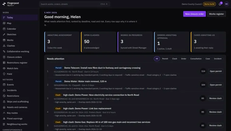
Today Sgrinlun Fingerpost 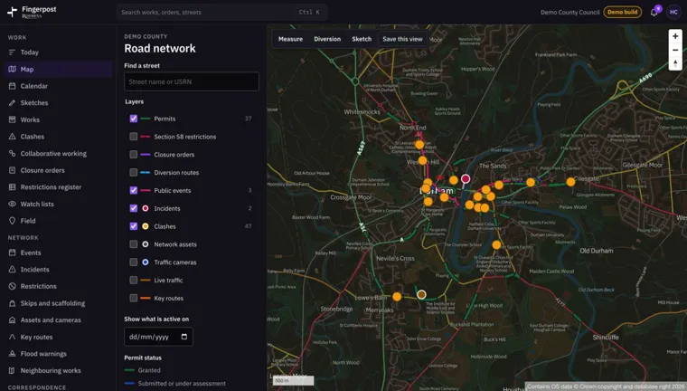
Road network map Sgrinlun Fingerpost 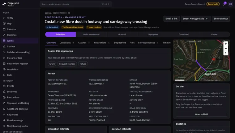
Permit assessment Sgrinlun Fingerpost 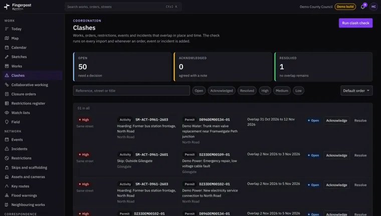
Clashes Sgrinlun Fingerpost 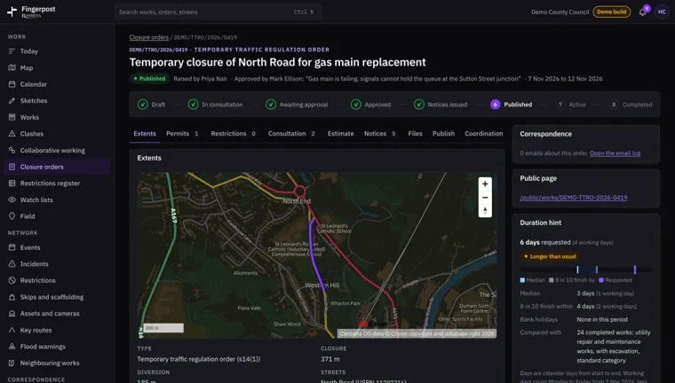
Closure order Sgrinlun Fingerpost